Drone inspections are accepted by many contractors and insurance adjusters today, and in some workflows, they are actively preferred, but that acceptance is conditional. They are considered fully valid when they improve safety and documentation while still fitting each carrier’s rules, evidence standards, and local practices.
Industry Adoption Overview
In construction and insurance, drones have moved from “nice gadget” to standard tool in many markets. Roofing and general contractors routinely use drones to document steep, brittle, or storm-damaged roofs because drones speed up sales calls and keep crews off dangerous slopes.
Independent and staff adjusters increasingly rely on drone imagery when ladder access is risky, when they’re handling high daily claim volumes, or when carriers have formal aerial inspection programs.
Major national carriers like Allstate, State Farm, USAA, Farmers, and Liberty Mutual (and their IA partners) either run their own drone programs or work with third-party providers, and many have internal guidelines describing how drone photos, orthomosaics, and measurements can be used in claims and underwriting.
Industry commentary and vendor case studies consistently point to a growing share of carriers integrating drone imagery into roof claims handling and risk assessment. Acceptance is still uneven, though: some offices and managers are very comfortable closing a claim based on aerial data and ground photos, while others still want “boots on the roof” whenever possible.
The real question a new Part 107 pilot must answer is not “are drones being used?” but “when is a drone inspection considered valid, sufficient, and billable by the people who sign the checks?” In practice, that comes down to whether your work product helps them make defensible decisions without creating more risk, friction, or re-inspections.
Why Contractors and Adjusters Like Drone Inspections
Safety and access
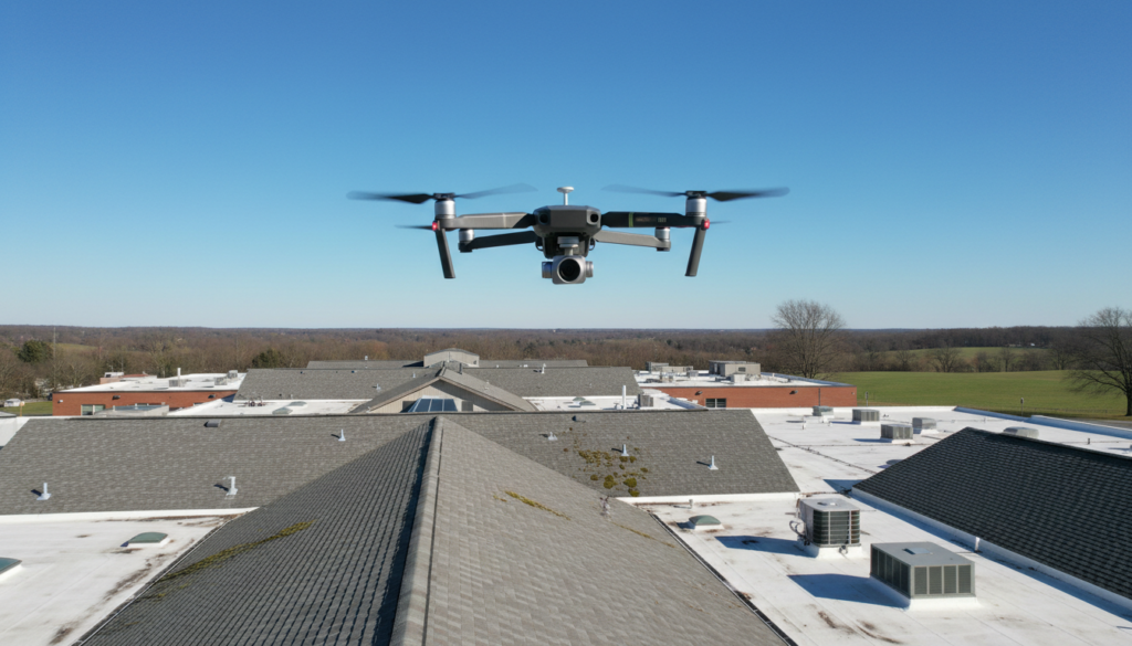
The biggest win is safety. If you can document a 10/12 or 12/12 pitch, a brittle 25‑year‑old shingle, or a roof with obvious structural compromise without anyone leaving the ground, you’ve just removed one of the highest-risk tasks in the job. That reduces fall exposure, workers’ comp risk, and the liability carriers worry about when they see adjusters on wet, icy, or storm-torn roofs.
Drones also open up roofs that are effectively “no-walk” for humans: very steep slopes, clay or slate roofs, metal panels in blazing heat, or surfaces where you can’t trust the deck after a hurricane or tree impact. Being the pilot who can safely obtain clear visuals of that kind of structure is a highly sellable capability.
Speed and efficiency
From a workflow perspective, a well-run drone inspection is typically several times faster than a ladder-and-walk inspection. You can capture complete coverage of the roof and elevations in minutes, rather than the time it takes to set up ladders, climb multiple slopes, move equipment, and manually document everything. Over a full day, this often allows a contractor salesperson or field adjuster to significantly increase the number of completed inspections, especially in CAT environments.
Speed doesn’t just mean more volume—it also means faster first contact, faster documentation to the desk adjuster, and quicker decisions on total vs. repair, supplements, or denials. For a contractor, it means getting from “lead” to “proposal” sooner, which increases close rates.
Documentation quality
Drones shine in the quality of the record they create. High-resolution nadir and oblique imagery, stitched orthomosaics, and (when needed) 3D models give you a time-stamped, geotagged visual record of the entire roof and structure. When you pair that with good labeling and callouts, you give adjusters and contractors something they can revisit at any point in the file’s life.
Used properly, you can:
- Show full‑roof context plus tight close‑ups of damage.
- Create roof outlines, slope labels, and measurement-ready models.
- Export measurements to estimating platforms such as Xactimate or AccuLynx-compatible tools.
- Attach image IDs directly to line items in a supplement or estimate.
That level of documentation reduces ‘he said, she said’ arguments and makes it easier for the next person in the chain, desk adjuster, manager, reinspector, to understand what actually exists on the roof, ” he said.
Fraud reduction and consistency
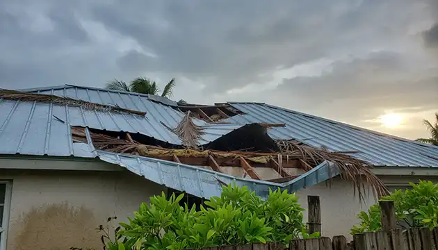
Because drones can be flown in a consistent pattern with preserved EXIF metadata (date, time, GPS), they’re useful for both fraud detection and honest documentation. Pre‑event “baseline” imagery paired with post‑event flights helps distinguish between pre-existing wear and new storm damage. Consistent capture patterns also help show if photos are cherry-picked or truly representative.
Example: post‑storm backlog
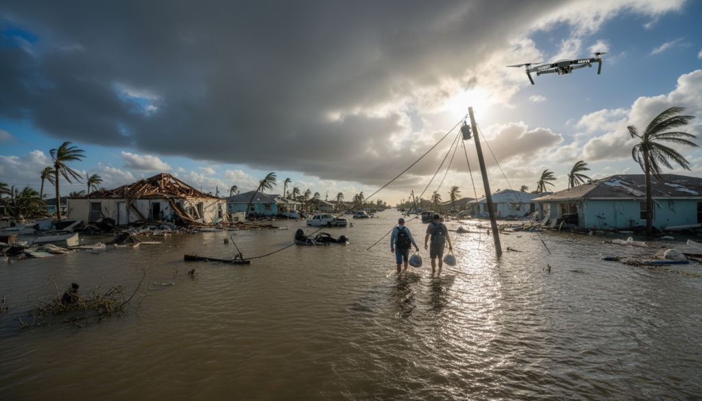
A common scenario: after a large hail or wind event, a carrier or IA firm is staring at thousands of new claims and not enough safe days to climb every roof. They deploy a mixed team—field adjusters with ladders for easy, low‑risk roofs, and drone crews for steep, high, or questionable structures.
Drones handle the “hard roofs,” feeding imagery and measurements to desk adjusters who can then settle many of those claims without ever sending another person up. That combination dramatically reduces the backlog and keeps staff out of the hospital.
Where Drone Inspections Are Fully Accepted
Exterior roof and elevations
Drone inspections are most accepted as the primary visual record for:
- Residential and small commercial roofs after hail, wind, or hurricane losses.
- Elevation documentation: siding, facias, gutters, chimneys, skylights, and penetrations.
- Underwriting and renewal inspections focused on roof age, condition, tree overhang, debris, and other visible hazards.
In these situations, many contractors and adjusters now expect high-quality aerial views as part of a professional package. For a contractor sales rep, showing a homeowner clean top-down and oblique shots is often part of the standard pitch. For adjusters, aerial roof documentation is increasingly a normal part of the file.
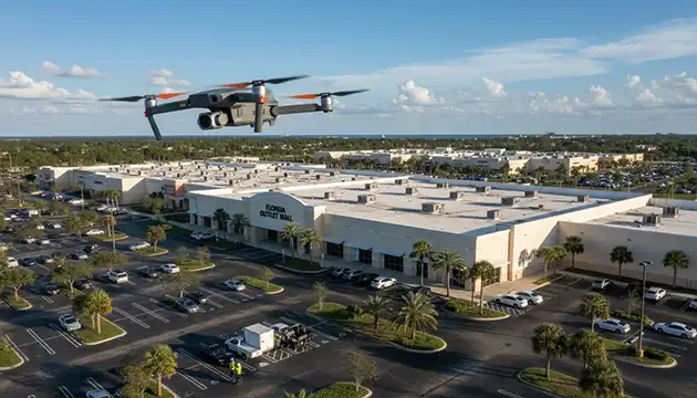
Catastrophe (CAT) deployments
In CAT operations, drones are often the only safe and scalable way to inspect large numbers of damaged structures. Carriers and IA firms will:
- Contract with drone service providers.
- Stand up internal “drone strike teams.”
- Or adopt software platforms that coordinate pilots and centralize imagery.
Here, drone inspections are not just accepted, they’re central to the CAT playbook. They allow quick triage: which roofs are total losses, which need temporary repairs, and which can wait.
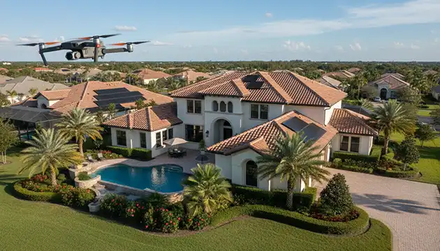
Baselining and risk assessment
Property managers, REITs, and owners of high‑value homes increasingly pay for drone baselines: “before” imagery that documents the current condition. When a storm hits, the “after” flight makes it far easier for carriers and adjusters to separate old issues from storm-created damage.
In all these use cases, drone products are not seen as a gimmick. They’re part of what a serious professional brings to the table.
Where Acceptance Is Limited or Conditional
Carrier policies and regional variation
Acceptance is not uniform. Some carriers (or specific regions, managers, or IA partners) have written or unwritten policies stating that a licensed adjuster must physically inspect the roof when feasible. In those cases, drone imagery is treated as a supplement, not a replacement: it’s fantastic for unsafe roofs or documenting what the adjuster can’t reach, but it doesn’t eliminate their duty to attempt access.
You will also run into carriers or local offices that tell contractors, “Drone photos alone are not enough.” That can frustrate contractors who rely on third-party drone-only reports and expect them to carry the same weight as an adjuster’s on‑roof inspection.
Evidence sufficiency and disputes
The more money at stake, the more likely someone will ask for more than aerial photos. In large or contentious claims, insurers, public adjusters, or engineers may insist on:
- On‑roof tactile inspections (feeling for soft decking, testing shingle flexibility).
- Core samples for flat roofs.
- Very close macro photography of individual shingles, fasteners, or membranes.
That’s because many coverage decisions hinge on subtle distinctions: hail vs blistering, mechanical damage vs wind creasing, improper installation vs storm-created loss. If the drone imagery is too high, too soft, or poorly angled, it may not answer those questions, and a more invasive inspection may be necessary.
Perception of bias and “false damage.”
Some adjusters and carriers are wary of third‑party drone reports commissioned directly by contractors or policyholders. They worry about:
- Selective photography: only shooting damaged areas, skipping slopes with light or no damage.
- Aggressive interpretation: normal aging or mechanical scuffs labeled as “hail hits” or “wind damage.”
- Lack of standardized methodology.
When a market has seen many low-quality or biased drone deliverables, adjusters become skeptical, and you may feel resistance even if your work is excellent. That’s why consistency and neutrality are critical.
Regulatory and privacy concerns
Flying drones over homes raises privacy and regulatory concerns. If a carrier is perceived as “spying” on insureds with unannounced drone flights, it can create customer backlash or political pressure. Some states and municipalities have specific rules or case law around aerial surveillance, nuisance, and trespass.
There have also been public reports of insurers using aerial imagery (manned or unmanned) to identify roof condition issues and then to non-renew or adjust coverage. Even when perfectly legal, those stories can make policyholders and regulators cautious, which in turn makes some carriers more conservative with how they formally incorporate drone inspections.
The bottom line: drone acceptance depends on clear policies, effective communication, and a pilot who respects legal and ethical boundaries.
What Insurance Companies Require in Drone Reports
Pilot and regulatory compliance
For commercial work in the U.S., carriers expect that:
- The pilot holds an FAA Part 107 Remote Pilot Certificate.
- All operations comply with Part 107 (VLOS, altitude limits, daylight or appropriate waivers, airspace approvals).
- Airspace is checked, and LAANC or waivers are in place when required.
Many enterprise clients will request your certificate, proof of recertification, and sometimes your standard operating procedures (SOPs) before adding you to their vendor list.
Documentation package
A “dump” of JPEGs is not what carriers want. A carrier-acceptable drone report typically includes:
- High-resolution photos and/or video with intact metadata (time, date, GPS).
- A logical set of views:
- Overall property and roof overview.
- Each slope from the nadir and oblique angles.
- Elevations and key details (penetrations, chimneys, gutters, siding, transitions).
- Close-ups of representative damage on each affected area.
- Flight logs and mission summary:
- Location, date, and time.
- Flight path and approximate altitudes.
- Weather conditions and visibility.
- An annotated damage report:
- Roof diagram with labeled slopes.
- Image numbers keyed to specific locations and findings.
- Short, factual descriptions (“Loss of granules with apparent mat exposure,” “Missing shingle at leading edge,” etc.).
- Compatibility with their tools:
- Measurements or exports that can be imported to Xactimate or similar estimating systems.
- File naming and organization that matches their internal structure.
Consistently delivering this puts you in a different category than “guy with a drone and a Dropbox link.”
Credentials and insurance
Larger clients will often require:
- General liability and aircraft liability coverage.
- Professional liability/errors & omissions coverage if you are interpreting findings or building reports that they rely on.
- Depending on your role, training, or certifications in Xactimate, flood/NFIP, or specific storm damage programs.
These aren’t always mandatory for small jobs, but they become more important as you move into enterprise-level work and high-value portfolios.
How Contractors Use Drone Inspections in Practice
Sales and documentation
Contractors primarily use drone imagery for communication and proof. Typical workflows:
- Pre‑inspection drone photos to show the homeowner what the roof looks like in areas they can’t see.
- Use of before-and-after photos in sales presentations to help owners understand the scope of damage and the value of a full replacement versus a patch.
- Providing annotated image sets to accompany supplements or change orders sent to adjusters.
When a supplement shows, for example, ice-and-water shield additions or extra waste for complex cuts, having precise aerial views backing it up often leads to less resistance.
Scoping and estimating
For large, steep, or complex roofs, contractors use drone-derived measurements to:
- Generate accurate squares, ridge/valley lengths, eave lengths, and pitch.
- Cross-check or replace manual wheel measurements.
- Feed data directly into their estimating and CRM systems.
This helps reduce costly underestimates and rework. It also makes it easier to standardize pricing and bids across a sales team.
Risk management
Drones are also used to protect the contractor:
- Documenting pre-existing granule loss, prior repairs, ponding, or structural issues before any work begins.
- Capturing post‑job completion photos to prove that vents, flashings, and shingles were in good order when they left.
Many contractors are comfortable relying on drone inspections as long as the images are sharp, coverage is complete, and the report is easy to understand and share with adjusters and homeowners.
How Adjusters Use Drone Inspections in Practice
Field adjusters
Field adjusters treat the drone as an extension of their toolkit. Common practices include:
- Using drones on roofs that are too steep, high, wet, or structurally questionable to walk safely.
- Combining drone roof images with:
- Ground-level photos.
- Interior damage documentation.
- Policy review and interviews with the insured.
- Capturing both the “big picture” of damage patterns and close‑ups of specific test squares or areas that they might otherwise have had to climb to reach.
For many field adjusters, drones are not replacing their judgment—they’re replacing a ladder on some portion of the file.
Desk adjusters
Desk adjusters rely on imagery and documentation produced by others, such as field adjusters, vendor pilots, or contractor-provided reports (where allowed). They use drone products to:
- Verify that damage patterns match reported storm dates and intensities.
- Confirm that the claimed slopes and materials are correct.
- Decide whether a reinspection, an engineer visit, or additional documentation is needed.
When your drone report is structured, neutral, and easy to navigate, a desk adjuster is more likely to trust it and less likely to kick the file back for rework.
Common Reasons Drone Inspections Get Rejected
Drone work gets rejected—or quietly ignored—when it creates more questions than answers. Common problems:
- Poor image quality:
- Blurry, noisy, or overexposed images.
- Too much altitude, not enough detail to evaluate damage.
- Incomplete coverage:
- Only one or two slopes were photographed.
- Missing ridge, hips, valleys, or critical elevations.
- Lack of context:
- Nothing shows the home’s full roof in relation to the surroundings.
- No orientation indicators (e.g., “north elevation,” “rear slope”).
- Disorganized deliverables:
- Random file names, no logical order.
- No index, no roof diagram, no link between images and locations.
- No evidence of compliance:
- No pilot info, no date/time stamps, no flight logs.
- Perceived bias:
- Only damaged areas shown, undamaged slopes omitted.
- Dramatic tight shots without wide views to provide scale or context.
- Misinterpretation:
- Normal wear, thermal blistering, installation defects, or manufacturer anomalies are labeled as storm damage without a proper basis.
A pilot who avoids these pitfalls and delivers a clean, objective package will see much higher acceptance and repeat business.
How a Drone Pilot Can Make Their Work “Carrier-Grade” Standardize your capture process. Create a repeatable flight template for roofs:
- Start with overall obliques to establish context.
- Fly a consistent grid or series of passes over each slope at an altitude that captures shingle-level detail.
- Capture all elevations at an angle that clearly shows cladding, windows, penetrations, and trim.
- Maintain consistent camera settings (shutter speed, ISO, white balance) to avoid motion blur and inconsistent exposure.
Use checklists so you don’t forget a slope, elevation, or key detail under pressure.
Build a professional report template
Your report should look like something an adjuster expects to see in their file:
- Cover page:
- Property address, insured name (if provided), claim or project number, and inspection date.
- Your company name, contact info, and Part 107 certificate number.
- Summary of findings:
- Short, factual overview of what was observed—avoid arguing coverage.
- Roof and site diagrams:
- Labeled slopes (e.g., Front/North, Rear/South).
- Callouts showing where key images were taken.
- Image tables:
- Image ID, location, and concise observation for each significant photo.
- Image appendix:
- All images in a logical order, preferably with captions.
When someone can answer “what is this picture showing and where?” in seconds, your value goes way up.
Stay within your lane
As a drone pilot, your strength is objective documentation, not adjusting or engineering (unless you also hold those licenses). So:
- Describe what you see:
- “Missing shingle at eave on front slope.”
- “Multiple circular areas of granule loss with apparent mat exposure.”
- Avoid making policy or causation statements if you are not qualified:
- Don’t write: “Hail-damaged and must be fully replaced under Coverage A.”
- Instead: “Multiple localized impact-like marks on upper rear slope shingles; see images 23–30.”
Neutral language makes adjusters and carriers more comfortable relying on your work.
Invest in training
To make truly carrier-grade deliverables:
- Study roof systems, installation methods, and common defects.
- Learn storm damage signatures:
- How hail, wind, and debris typically present on different materials.
- Get basic familiarity with Xactimate or the estimating tools your clients use.
- Learn how various carriers define “functional damage” versus cosmetic or age-related issues.
You don’t need to be an adjuster, but you do need to understand what they’re looking for.
How to Talk About Acceptance with Prospective Clients
With contractors
Lean on benefits that matter to owners and sales teams:
- Safety and reduced liability (“We can document any roof without putting your people in harm’s way.”)
- Speed and professionalism (“We turn around a clean, labeled report that you can hand to both the homeowner and the adjuster.”)
- Integration (“Our measurements and photos are formatted so your office can drop them right into your estimating and CRM systems.”)
Example positioning:
“We capture full-roof imagery and measurements the same way insurance carriers and adjusters document losses. That means when you submit a claim file, everyone is literally looking at the same roof from the same angles, which reduces pushback and confusion.”
With adjusters and carriers
Emphasize risk reduction and alignment with their standards:
- Compliance:
- Part 107 licensed, insured, and operating under written SOPs.
- Transparency:
- Flight logs, metadata, and consistent capture patterns that support audits and, if necessary, legal review.
- Familiarity:
- Reports are structured around roof diagrams, labeled slopes, and image indices that mirror the internal guidelines they already use.
Example talking point:
“My role is to provide objective, high-resolution documentation in a format that plugs directly into your existing workflows. You still make the coverage and damage decisions; I make sure you can see the roof clearly without taking unnecessary risks.”
Always ask new clients: “How do you like your documentation?” Then adjust your template to fit.
Future Trends: Where Acceptance Is Heading
The trajectory is toward more, not less, drone involvement. Expect:
- Increased automation and AI:
- Software that flags likely hail hits, wind creases, missing components, and pooling water from imagery.
- Deeper carrier partnerships:
- More insurers are working with specialized drone platforms that standardize capture patterns, naming conventions, and report formats.
- Expansion beyond roofs:
- Regular drone inspections of solar arrays, building facades, towers, and other infrastructure assets, normalizing drones in the eyes of risk managers.
- Regulatory evolution:
- Gradual movement toward more flexible beyond visual line of sight (BVLOS) rules in controlled contexts, which will make large-scale CAT operations more efficient.
As those trends mature, drone-based inspections will be less of an “extra” and more of an embedded piece of the property insurance and construction ecosystem.
Bringing It All Together
Drone inspections are accepted and often welcomed by contractors and many insurance adjusters when they:
- Improve safety and efficiency.
- Deliver clear, objective, well-organized documentation.
- Fit within carrier policies and evidence standards.
- Are performed by a compliant, trained, and professional operator.
Acceptance is not automatic just because you show up with a drone. Treat the drone as one part of a professional process: know the rules, understand how your process actually works, and aim for carrier-grade documentation every time.