Mapping
- High-Resolution Aerial Mapping for Commercial Properties
- Orthomosaic Maps for Site Planning and Due Diligence
- 3D Models and Digital Surface Models for Land Development
- Drone Mapping for Vacant Land and Large Acreage Sites
- Parking Lot, Access Road, and Site Layout Mapping
- Accurate Area, Distance, and Volume Measurements
- Mapping for Engineers, Developers, and Investors
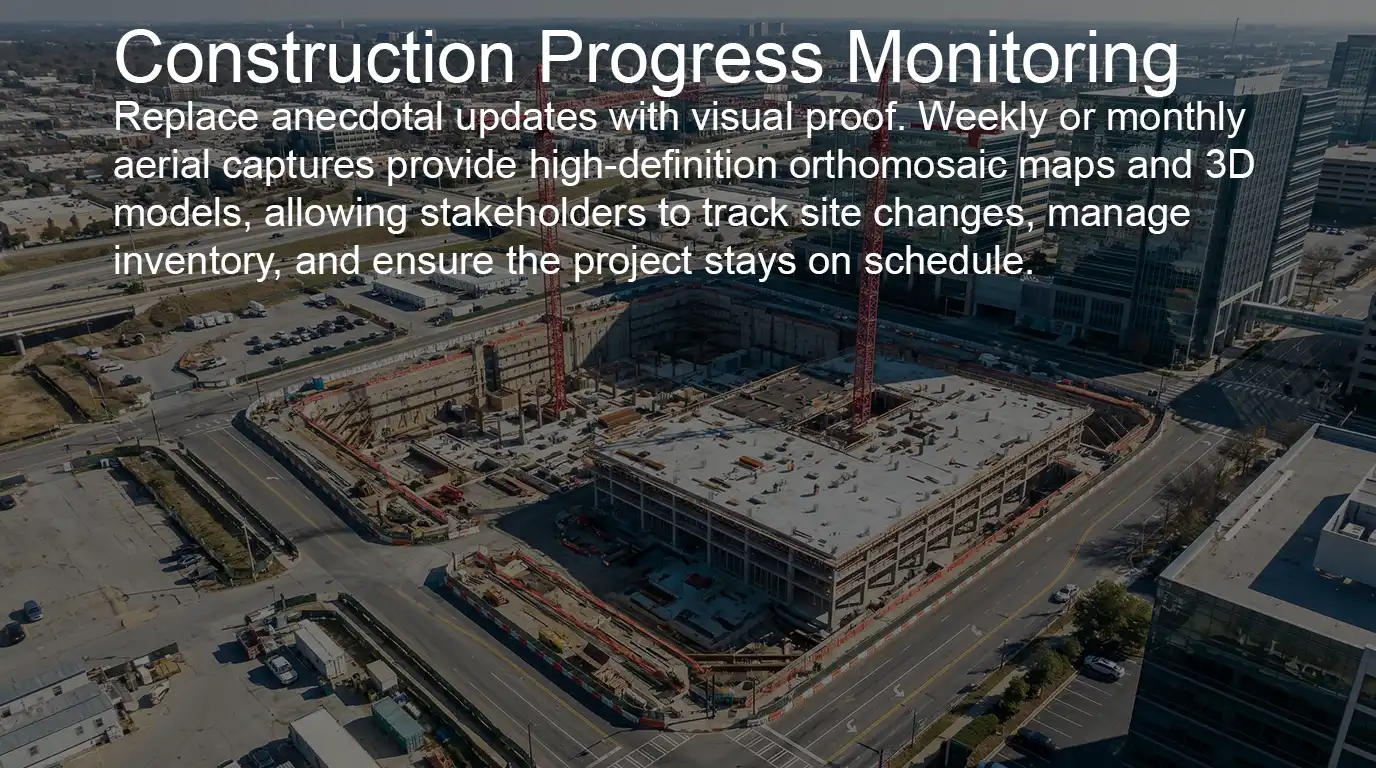
Construction
- Time-Lapse Progress Mapping Weekly and Monthly Aerial
- High-Resolution Mapping for Planning and Layout
- Inventory Tracking for Materials, Equipment, and Storage Yards
- Earthwork and Stockpile Volume Measurements
- Safety and Site Condition Monitoring from an Aerial Perspective
- Marketing and Investor Update Videos for Major Construction Projects
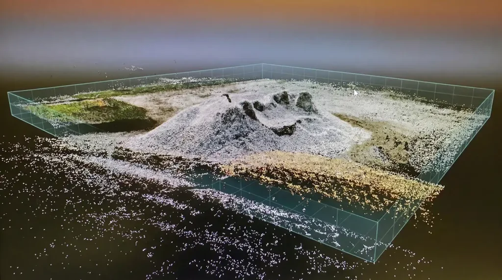
Precision Volumetrics: Because “Close Enough” is Expensive
Dirt and aggregate are the largest variables in any construction budget. Without precise data, you are at the mercy of truck tickets and “best-guess” surveying. Our high-density 3D measurements replace estimates with an indisputable digital record of your site’s profitability.
The Source of Truth for Earthwork
- Eliminate the Guesswork: We convert millions of data points into precise cubic yardage reports for stockpiles, trenches, and grading.
- Optimize Logistics: Know exactly how many trucks you need and where material is located, slashing idle time and fuel costs.
- Real-Time Progress Tracking: Monitor site balance weekly to ensure subcontractors are adhering to the plan before errors are buried.
Field Report: Identifying the Discrepancy
On a recent large-scale development, a prime contractor was billed for a massive volume of aggregate delivered and spread across the site. While the truck tickets suggested the project was on track, the visual progress on the ground didn’t match the invoicing.
The Intervention: By comparing the current 3D topography against the initial pre-disturbed survey, we calculated the exact volume of material actually added to the site.
The Result: The data revealed a significant shortage compared to the subcontractor’s billing—a discrepancy caused by inaccurate truck counts and inconsistent reporting.
The Bottom Line: Because we had been performing consistent weekly inspections, the contractor held a clear advantage in the dispute. There was no room for debate; the chronological data trail provided an undeniable “source of truth” that sided with the contractor. This resulted in substantial savings and prevented a massive budget overrun during the most critical phase of the project.
Stop Disputes Before They Start
When you have a 3D digital twin of your site, you don’t have to argue. You have the data. We provide the documentation you need to keep subcontractors aligned, verify every yard of material, and protect your margins.
Why Work With Flight Above
Latest Equipment and Workflows
Flight Above delivers professional aerial services tailored to infrastructure, development, and commercial projects. From telecom towers and utility assets to large construction sites and land development, our team provides precise aerial mapping, inspections, and progress documentation that help clients make better decisions faster.
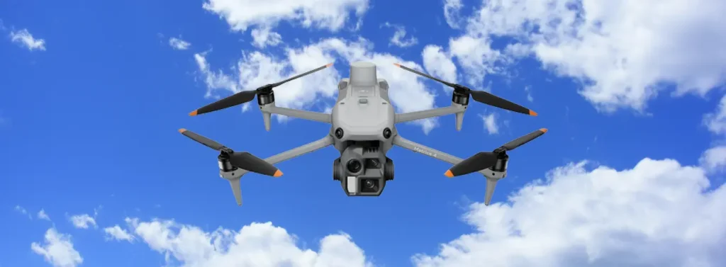
Using advanced drone platforms such as the DJI Matrice 4 Enterprise and Mavic 3 Enterprise and a cinawhoop drone to get the tight interior fly-throughs, along with industry-standard mapping workflows like DroneDeploy and Pix4D, we capture high-resolution imagery, orthomosaics, and detailed visual reports that provide clear insight into site conditions, structural integrity, and project progress.
Whether a client needs site planning data, construction monitoring, or infrastructure documentation, Flight Above delivers reliable aerial intelligence with fast turnaround and professional reporting.
Pilot Network Licensed and Fully Insured
Clients choose Flight Above because we combine aviation expertise with real-world infrastructure experience. Our operations follow strict safety procedures under FAA Part 107 regulations, and we maintain $1 million in liability insurance to ensure every project is conducted with professionalism and accountability.
In addition, Flight Above maintains a network of qualified and vetted drone pilots, allowing us to scale quickly and provide reliable aerial coverage for projects of any size or location.
This network ensures consistent service for developers, engineers, telecom operators, utilities, and construction managers who require dependable documentation and rapid deployment.
From early site planning and due-diligence mapping to ongoing construction progress videos and infrastructure inspections, Flight Above provides aerial solutions that improve visibility, reduce risk, and help projects move forward with confidence.
Contact us for additional Information and deliverables
For more information about our aerial services and standard deliverables, we invite you to contact Flight Above directly. Our team is available to discuss project requirements, mapping specifications, inspection needs, and custom aerial documentation solutions tailored to your site or infrastructure project.
Whether you need orthomosaic mapping, construction progress monitoring, infrastructure inspections, or specialized aerial data collection, we are happy to review your project details and recommend the most efficient approach.
Reach out today to learn how Flight Above can support your project with professional drone services and reliable aerial intelligence.